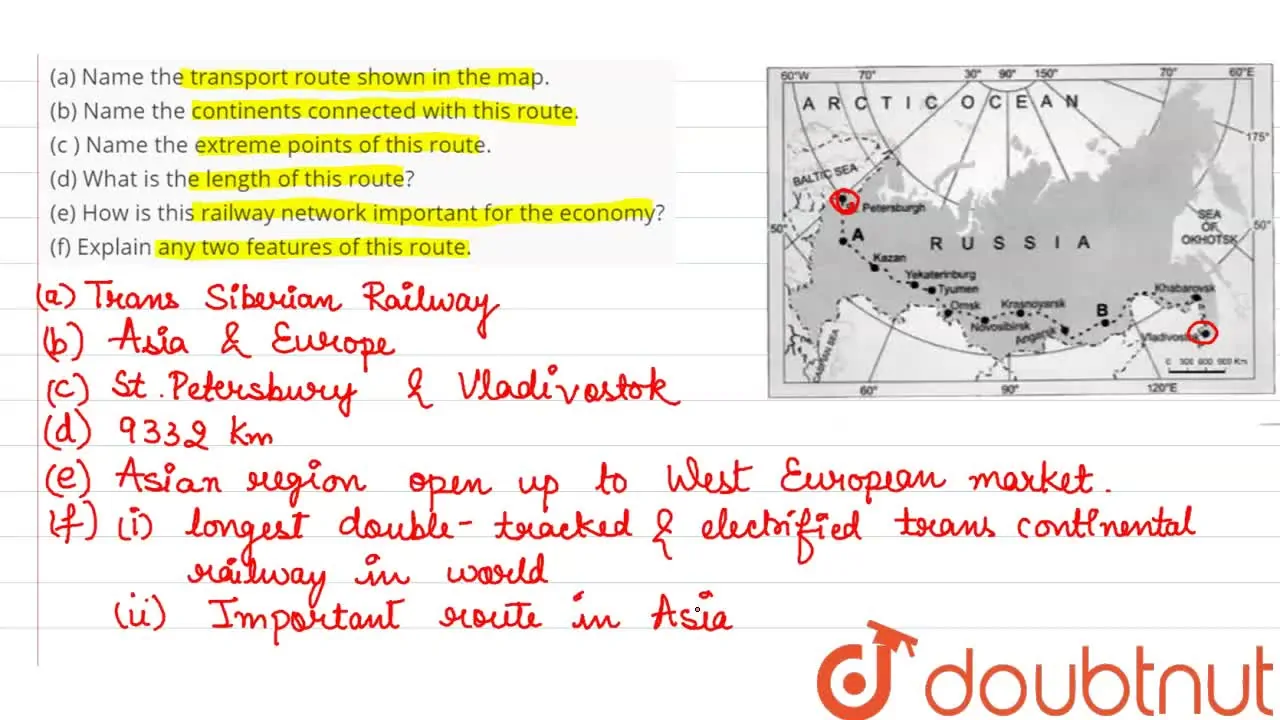
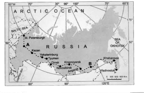
Study the map given below and answer the questions that follow:
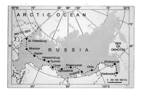
(a) Name the transport route shown in the map.
(b) Name the continents connected with this route.
(c ) Name the extreme points of this route.
(d) What is the length of this route?
(e) How is this railway network important for the economy?
(f) Explain any two features of this route.
(a) Trans-Siberian Railway
(b) Asia and Europe
(c) In the West, it is St. Petersburg and in the east it is Vladivostok
(d) 9332 km
(e) This route has helped in opening up its Asian region to west European markets. It is the most important rail network in Asia.
(f) Two features of this route are as follows:
(i) It is the longest double-tracked and electrified trans-continental railway in the World.
(ii) It is the most important route in Asia.
Related Playlists
- BOOK - FULL MARKSCHAPTER - TRANSPORT AND COMMUNICATION EXERCISE - PRIVIOUS YEARS BOARD QUESTIONS SOLVED (I Very Short Answer Type Questions)17videos
TRANSPORT AND COMMUNICATION
- BOOK - FULL MARKSCHAPTER - TRANSPORT AND COMMUNICATION EXERCISE - PRIVIOUS YEARS BOARD QUESTIONS SOLVEd (II Short Answer Type Questions)19videos
TRANSPORT AND COMMUNICATION
- BOOK - FULL MARKSCHAPTER - TRANSPORT AND COMMUNICATION EXERCISE - ADDITIONAL QUESTIONS SOLVED (III. Long Answer Type Questions)18videos
TRANSPORT AND COMMUNICATION
- BOOK - FULL MARKSCHAPTER - THE WORLD POPULATION DISTIBUTION, DENSITY AND GROWTH EXERCISE - WORKSHEET15videos
THE WORLD POPULATION DISTIBUTION, DENSITY AND GROWTH
- BOOK - FULL MARKSCHAPTER - USE OF COMPUTER IN DATA PROCESSING AND MAPPINGEXERCISE - TEST ASSIGNMENT5videos
USE OF COMPUTER IN DATA PROCESSING AND MAPPING
Similar Questions
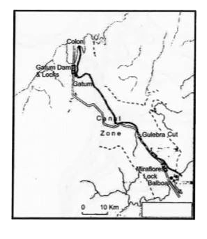
Study the map given below carefully and answer the questions that follow:
15.1 Identify and name the canal shown in the map.
15.2 State any four features of this canal.
 View Solution
Study the following map carrefully and answer the question given below:
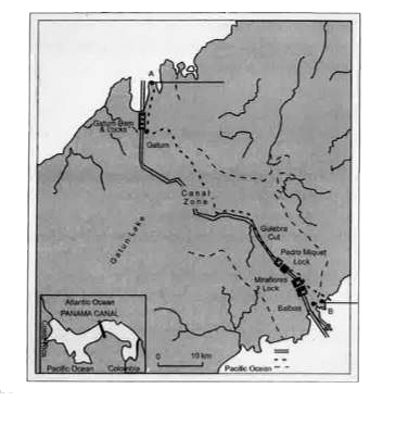
(a) Name the waterway shown in the map.
(b) Name the points A and B.
(c) What is the length of this route?View SolutionStudy the map given below carefully and answer the question that follow:
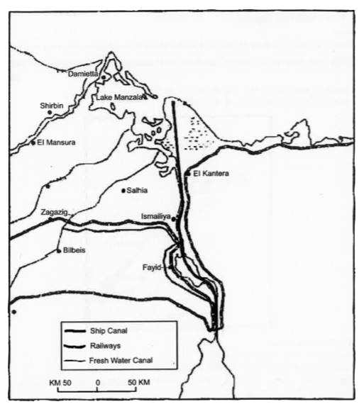
16.1. Identify and name the canal shown in the map.
16.2. Write any four characteristics of this canal.View SolutionStudy the following map and answer the questions given below:
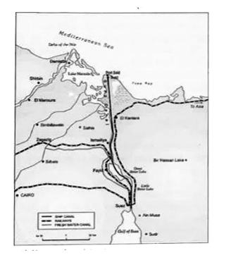 (i) Name the shipping canal shown in the map.
(ii) Name the Northernmost and Southern most port cities of this canal.
(iii) Which two continents have made more use of this canal?View SolutionStudy the following map of the Suez Canal carefully and answer the questions that follow:
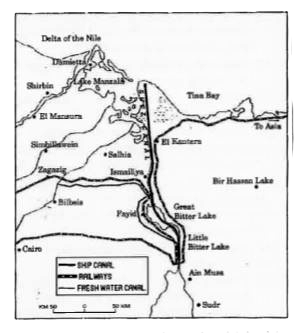
(a) Name the country through which this canal passes.
(b) Name the seas connected by this canal.
(c) Why is this canal considered a gateway of Europe to the Indian Ocean?View SolutionStudy the following map and answer the questions given below:
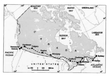
(i) Name the trans-continental railway shown in the given map.
(ii) Name the terminal stations of this railway line.
(iii) Mentioned any two characteristics of this railway line.View SolutionStudy of following map and answer the questions given below:
(i) Name the railway line shown in this map.
(ii) In which country does this railway line lie?
(iii) Name the station marked in the map as A and B.View SolutionStudy the following map and answer the question given below:
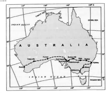
(i) Name the railway line shown in this map.
(ii) In which country does this railway line lie?
(iii) Name the two ocean coasts which are linked by this railway line.View SolutionExplain any three characteristics of Silk Routes?
View SolutionStudy the diagram given below and answer the questions that follow:
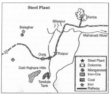
(i) Identify and name the steel plant given above. In which State is this plant located?
(ii) Which is the main source of power for this steel plant? Which rail route provides transport facilities to this plant?
What are the major sources of iron-ore and water for this steel plant?View Solution

