Study of following map and answer the questions given below:
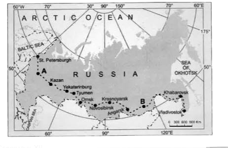
(i) Name the railway line shown in this map.
(ii) In which country does this railway line lie?
(iii) Name the station marked in the map as A and B.
(i) Trans-Siberian Railway.
(ii) Russia.
(iii) Station A marked in map is Moscow and station B marked in the map is Chita.
Topper's Solved these Questions
- TRANSPORT AND COMMUNICATION BOOK - FULL MARKSCHAPTER - TRANSPORT AND COMMUNICATION EXERCISE - PRIVIOUS YEARS BOARD QUESTIONS SOLVEd (III. Long Answer Type Questions)
22 Videos
- TRANSPORT AND COMMUNICATION BOOK - FULL MARKSCHAPTER - TRANSPORT AND COMMUNICATION EXERCISE - WORKSHEET
9 Videos
- TRANSPORT AND COMMUNICATION BOOK - FULL MARKSCHAPTER - TRANSPORT AND COMMUNICATION EXERCISE - PRIVIOUS YEARS BOARD QUESTIONS SOLVED (I Very Short Answer Type Questions)
17 Videos
- THE WORLD POPULATION DISTIBUTION, DENSITY AND GROWTH BOOK - FULL MARKSCHAPTER - THE WORLD POPULATION DISTIBUTION, DENSITY AND GROWTH EXERCISE - WORKSHEET
15 Videos
- USE OF COMPUTER IN DATA PROCESSING AND MAPPINGBOOK - FULL MARKSCHAPTER - USE OF COMPUTER IN DATA PROCESSING AND MAPPINGEXERCISE - TEST ASSIGNMENT
5 Videos
Similar Questions
Study the following map and answer the question given below:
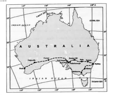
(i) Name the railway line shown in this map.
(ii) In which country does this railway line lie?
(iii) Name the two ocean coasts which are linked by this railway line.
View SolutionStudy the following map and answer the questions given below:
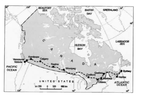
(i) Name the trans-continental railway shown in the given map.
(ii) Name the terminal stations of this railway line.
(iii) Mentioned any two characteristics of this railway line.
View Solution
Knowledge Check
In which color are the railway lines and telephone lines shown in the topographic map?
ABlueBYellowCBlackDRedIn which color are the railway lines and telephone lines shown in the topographic map?
AYellowBBlackCBlueDRed
Study the following map carrefully and answer the question given below:
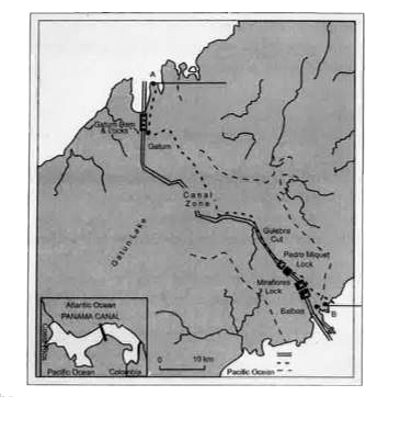
(a) Name the waterway shown in the map.
(b) Name the points A and B.
(c) What is the length of this route?
View SolutionStudy the following map and answer the questions given below:
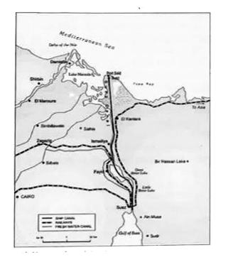 (i) Name the shipping canal shown in the map.
(ii) Name the Northernmost and Southern most port cities of this canal.
(iii) Which two continents have made more use of this canal?
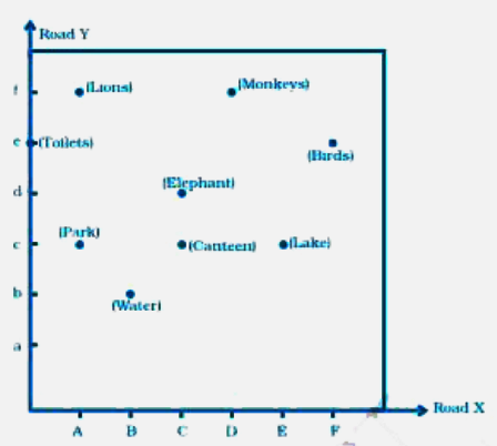
View SolutionStudy the given map of a zoo and answer the following questions.
View SolutionStudy the map given below aand answer the questions that follow :
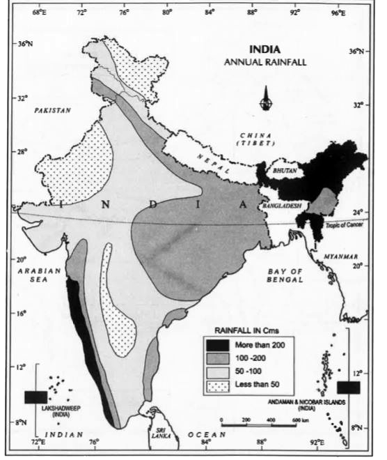
What is variability of rainfall ?
View SolutionStudy the map given below aand answer the questions that follow :
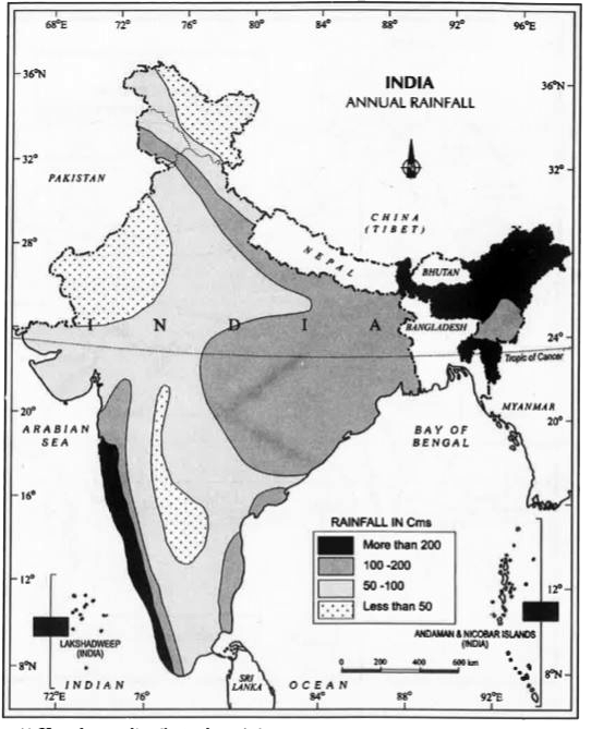
How do you distribute the rainfall in India ?
View SolutionStudy the following diagram and answer the questions that follow:
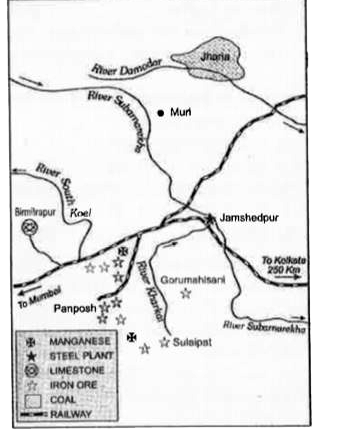
(i) Identify and name the steel plant shown in this diagram.
(ii) Name the mining fields which supply coal and limestone to this plant.
(iii) Mention the source of water for this plant.
View Solution
