An atlas of a country is shown in the figure, the distance between cities A and B is______
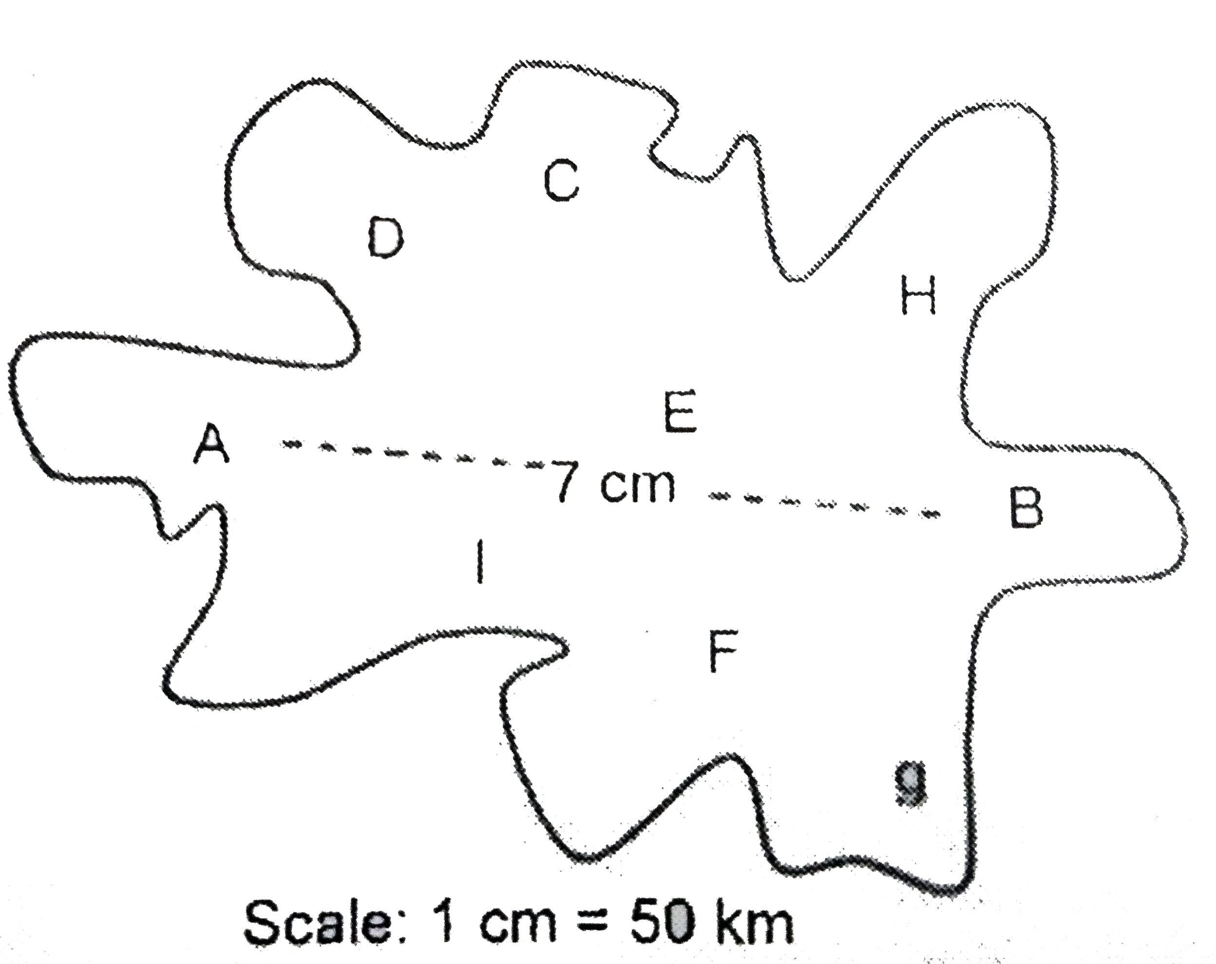
A
35 km
B
3500 km
C
350 km
D
both a and b
Video Solution
Text Solution
The correct Answer is:C
|
Answer
Step by step video, text & image solution for An atlas of a country is shown in the figure, the distance between cities A and B is______ by Physics experts to help you in doubts & scoring excellent marks in Class 7 exams.
Updated on:21/07/2023Topper's Solved these Questions
- MEASUREMENTSBOOK - PEARSON IIT JEE FOUNDATIONCHAPTER - MEASUREMENTSEXERCISE - Match the Column
6 Videos
- MEASUREMENTSBOOK - PEARSON IIT JEE FOUNDATIONCHAPTER - MEASUREMENTSEXERCISE - Answer The following Question
40 Videos
- MACHINES AND TOOLSBOOK - PEARSON IIT JEE FOUNDATIONCHAPTER - MACHINES AND TOOLSEXERCISE - CONCEPT APPLICATION (LEVEL 2)
12 Videos
- MOCK TESTBOOK - PEARSON IIT JEE FOUNDATIONCHAPTER - MOCK TESTEXERCISE - MULTIPLE CHOICE QUESTION
25 Videos
Similar Questions
Knowledge Check
What is the distance OA for the square shown in figure :-
 A35kmB3500mC350kmDBoth a and b
In the figure shown, the total resistance between A and B is
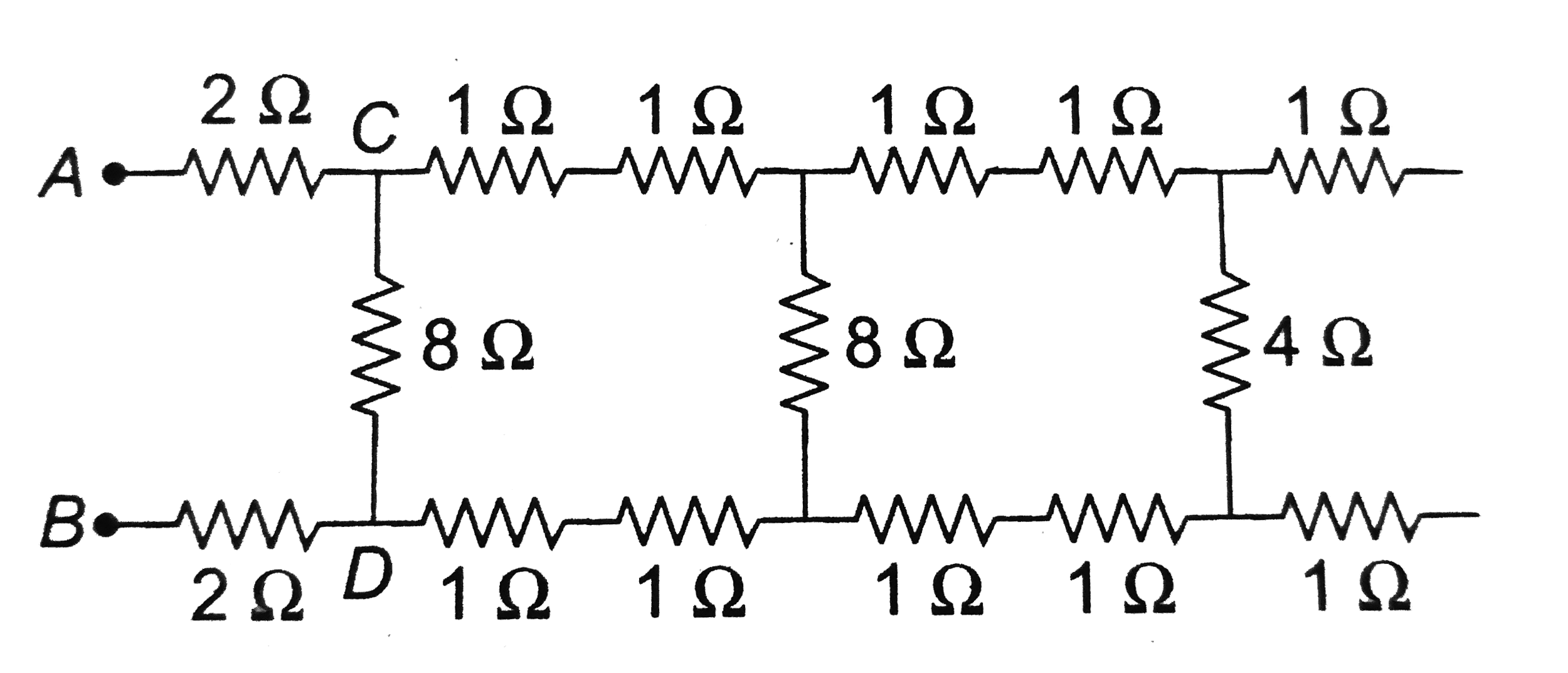 A12ΩB4ΩC6ΩD8Ω
In the figure shown, the total resistance between A and B is
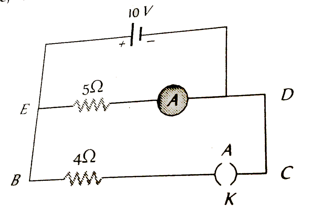 A50 AB2AC0.5AD109A
Five resistances are connected as shown in figure. The effective resistance between A and B is
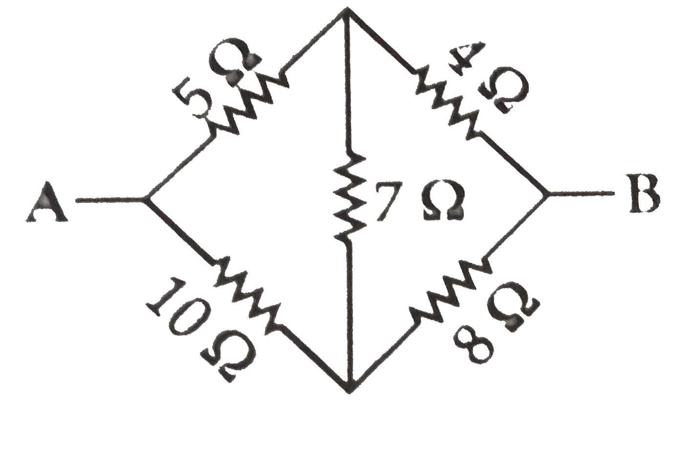
View SolutionIn the circuit as shown in the figure the effective capacitance between A and B is
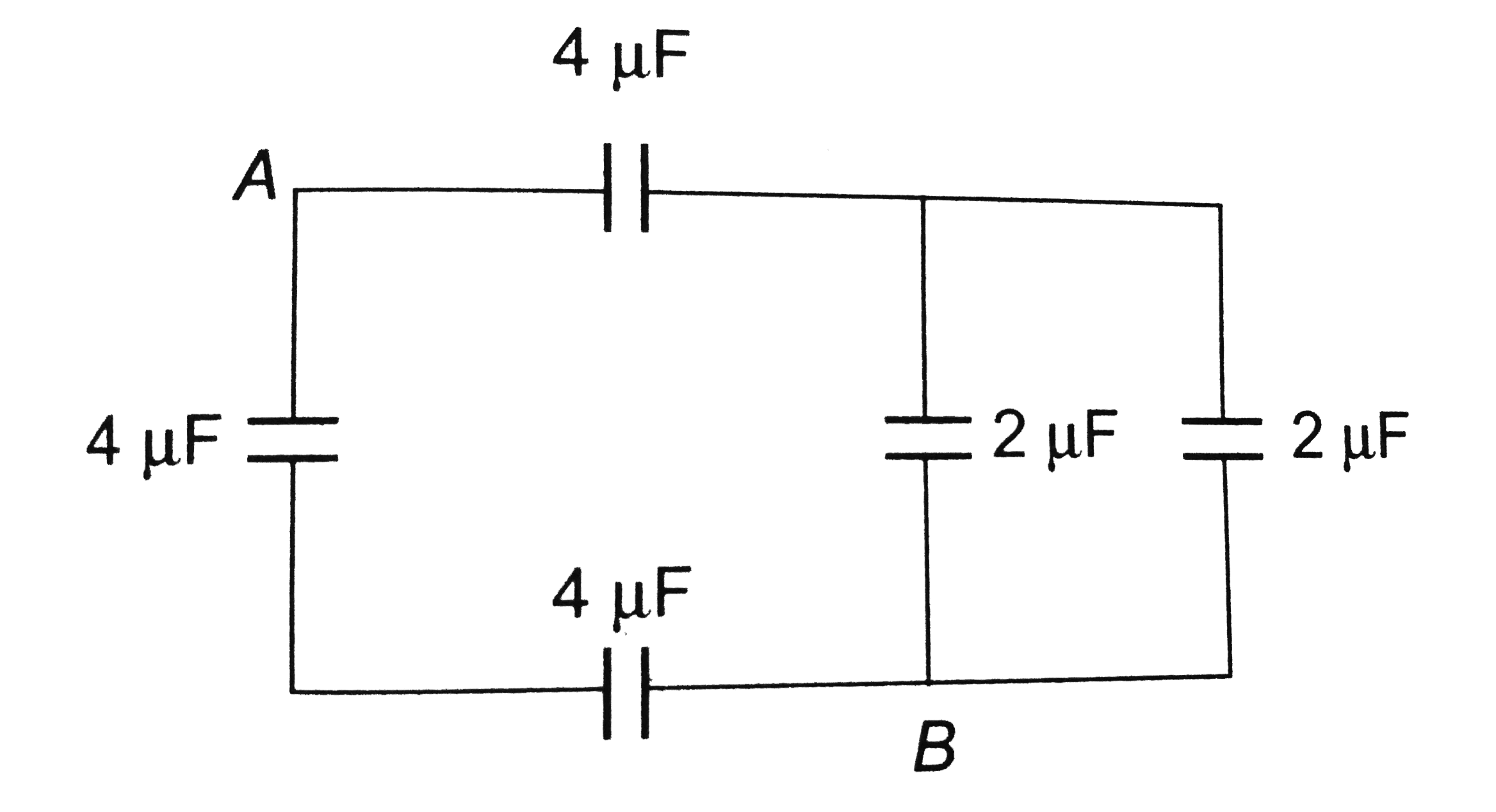
View SolutionIn the circuit as shown in the figure the effective capacitance between A and B is

View SolutionIn the circuit shown in figure potential difference between A and B is

View SolutionA number of resistors are connected as shown in the figure. The equivalent resistance between A and B is
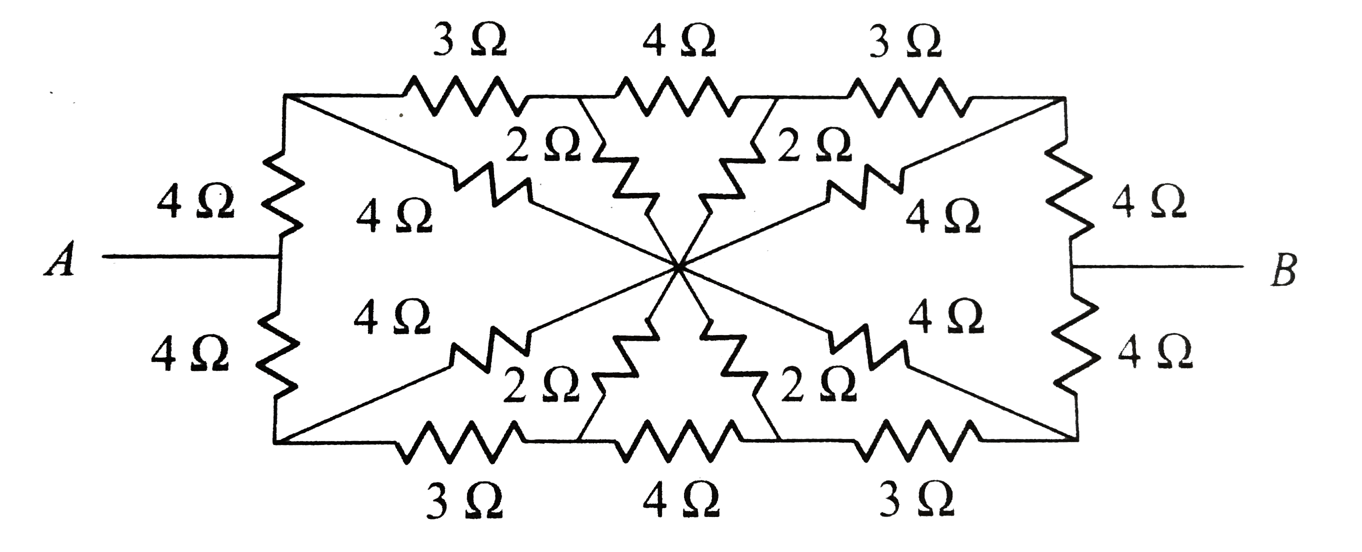
View Solution

